
Locations and Map Charts in TableStudio
Use LOCATION, COUNTRY, DISTANCE, POLYLINE, and AREA formulas with map charts based on local GeoNames data.
TableStudio supports location-aware cells for simple map work.
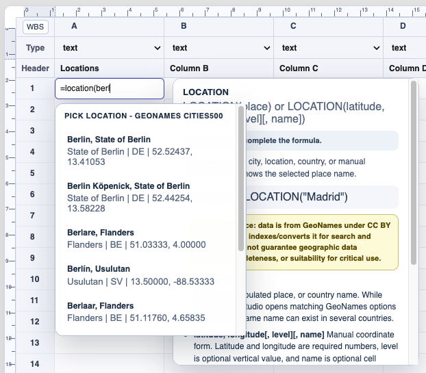
Use =LOCATION("Madrid") to search local GeoNames data and store the selected place. The cell shows the place name, while the stored value also keeps the coordinates.
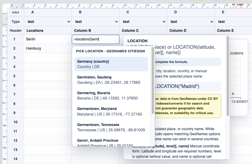
Use =COUNTRY("Germany") when the cell should store a country instead of a city or place.
Use manual coordinates with =LOCATION(latitude, longitude[, level][, name]). The optional level can store an elevation or vertical value, and the optional name controls what the cell displays. If another cell already contains a GPS coordinate pair, for example from =CONVERT(coord,s70,gps,...) or =CONVERT(c,S70,gps,A1,A2), use =LOCATION(A1, level, name).
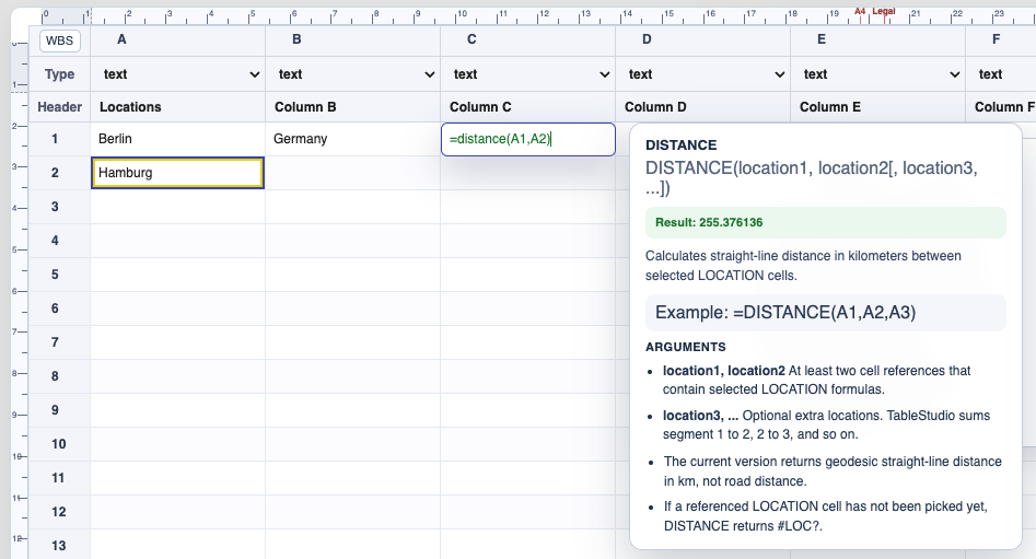
Use =DISTANCE(A1,A2) to calculate straight-line distance between location cells. If more than two locations are passed, TableStudio sums the route from point to point.
Use =POLYLINE(...) to store a map line and =AREA(...) to store a map polygon. AREA cells show the calculated area with units.
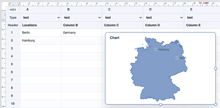
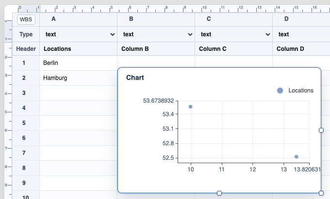
A map chart reads location, country, polyline, and area cells from its source range. Countries draw borders when included in the source. Locations draw dots. Polylines and areas draw line and polygon geometry.
GeoNames notice: location data is from GeoNames under CC BY 4.0. WorkStudio indexes/converts it for search and maps, but does not guarantee geographic data accuracy or suitability for critical use.
Related: CONVERT, Convert GPS and Stereo70 Coordinates in TableStudio, TableStudio Functions, Create a Map Chart from Locations, Charts in TableStudio, Copyright.
Location picker
When several places share a name, choose the correct location from the picker.
Country picker
COUNTRY accepts country records and stores the selected country.
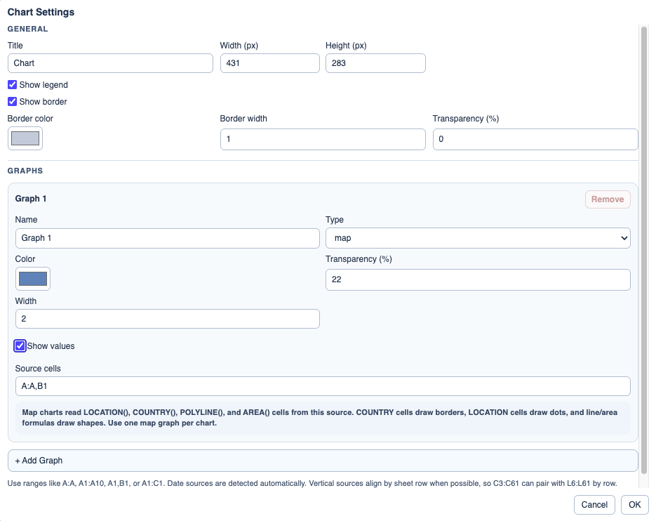
Map settings
Map charts use one source range because latitude and longitude come from the stored location data.
Locations without a country border
A map chart can show only locations when no country is included in the source.
Distance result
DISTANCE returns a calculated value with appropriate units.
Enable JavaScript to use reading progress and usefulness ratings.