
Convert GPS and Stereo70 Coordinates in TableStudio
Use CONVERT to transform GPS/WGS84 latitude-longitude values to Romanian Stereo70 x-y coordinates and back.
Use this walkthrough when you receive coordinates in GPS/WGS84 or Romanian Stereo70 and need the other system without leaving TableStudio.
The key idea is simple: GPS/WGS84 uses latitude, longitude; Stereo70 uses x, y meters. CONVERT handles both directions and the result can be used by LOCATION, map charts, distance, polyline, and area formulas.
Related: CONVERT, Locations and Map Charts in TableStudio, TableStudio Functions.
Start with the coordinate order
Decide which system is the source. GPS/WGS84 is latitude, longitude in decimal degrees. Stereo70 is x, y in meters.
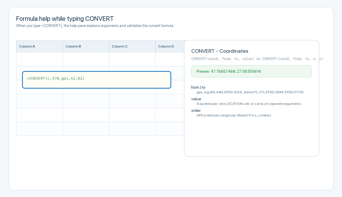
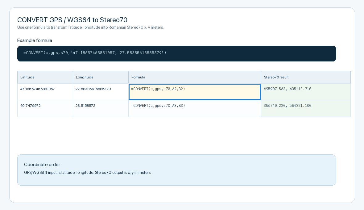
Convert GPS to Stereo70
For GPS input, use =CONVERT(c,gps,s70,"lat, lon") or use separate cells such as =CONVERT(c,gps,s70,A2,B2). The result is Stereo70 x, y in meters.
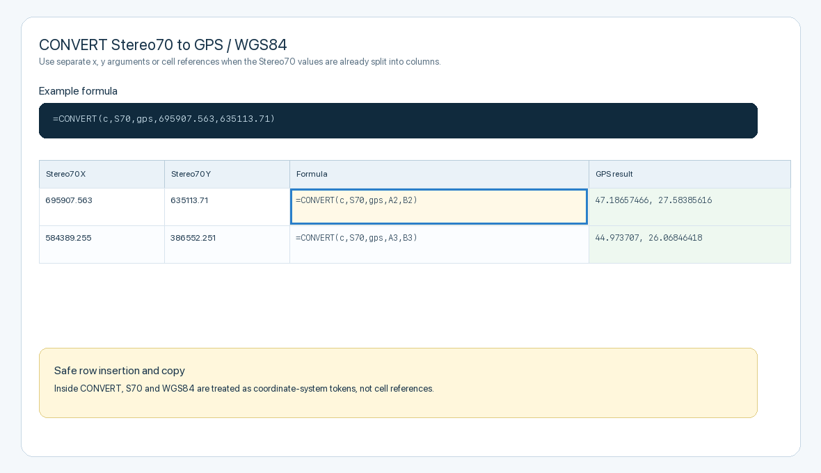
Convert Stereo70 to GPS
For Stereo70 input, use =CONVERT(c,S70,gps,x,y), for example =CONVERT(c,S70,gps,A2,B2). The result is WGS84 latitude, longitude.
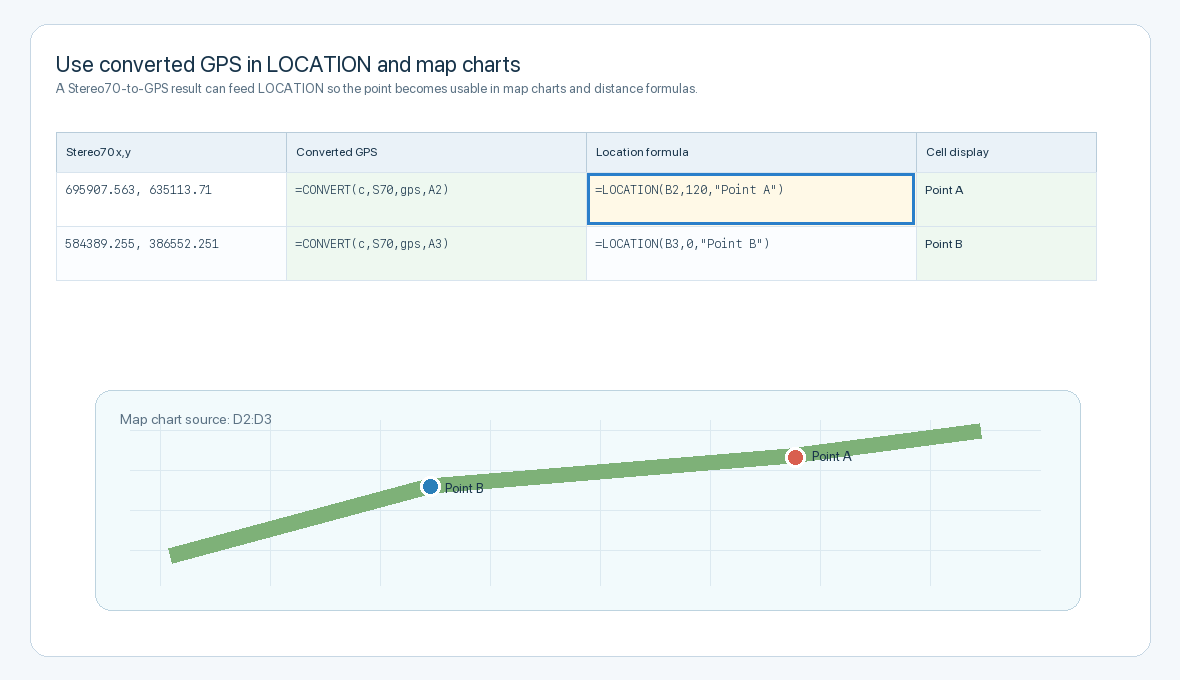
Use the result as a location
When a cell contains a converted GPS pair, use =LOCATION(A1, level, name) to store it as a location-aware cell. That point can be used in map charts and distance formulas.
Copy formulas safely
You can copy the formula or insert rows above it. Inside CONVERT, tokens such as S70, WGS84, and EPSG:3844 remain coordinate-system names; normal cell references such as A2 and B2 still adjust as expected.
Enable JavaScript to use reading progress and usefulness ratings.